IAI-3D Mapping
Real-time Advanced 2D/3D Maps Generation…
About 3D Mapping
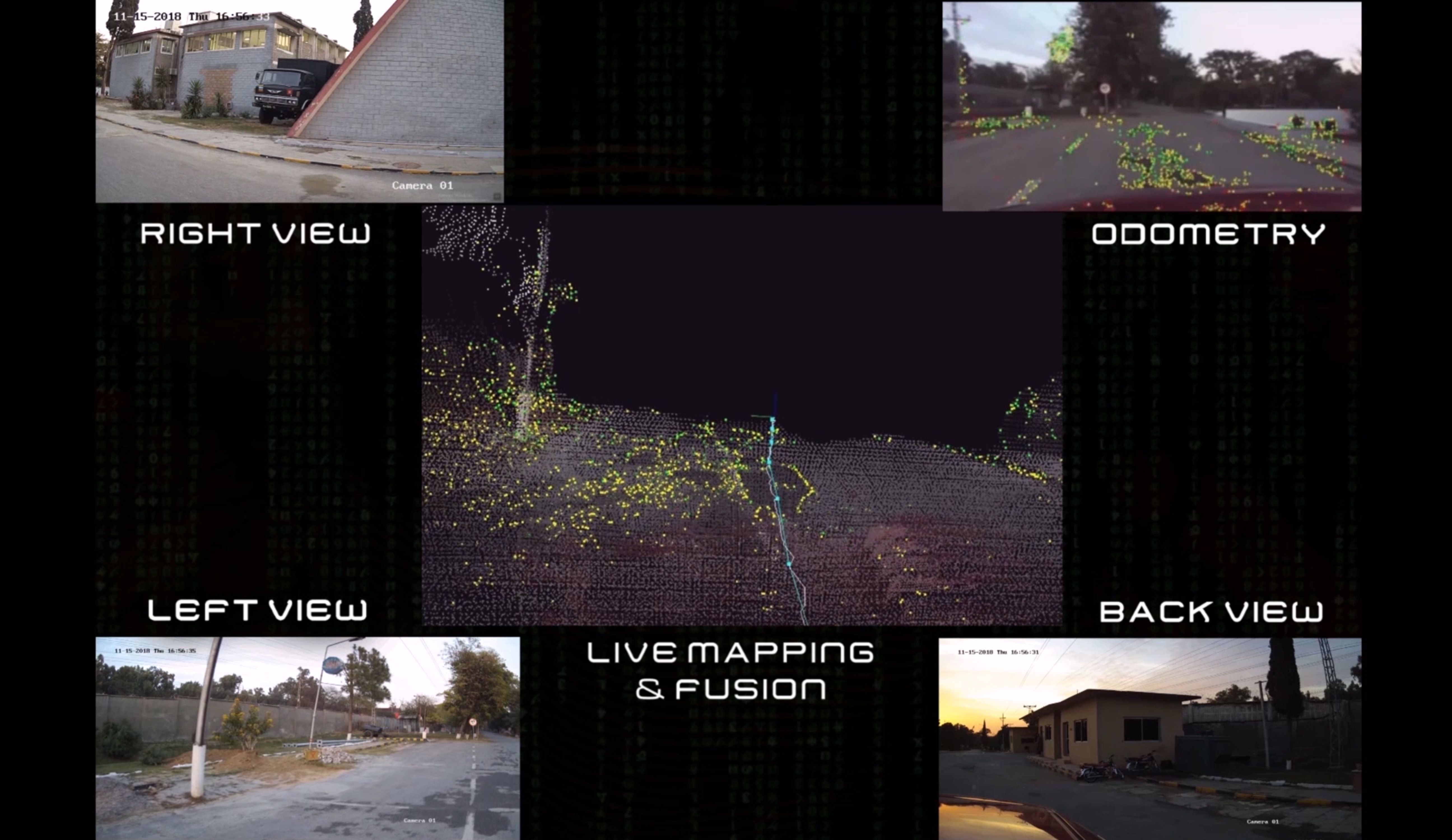
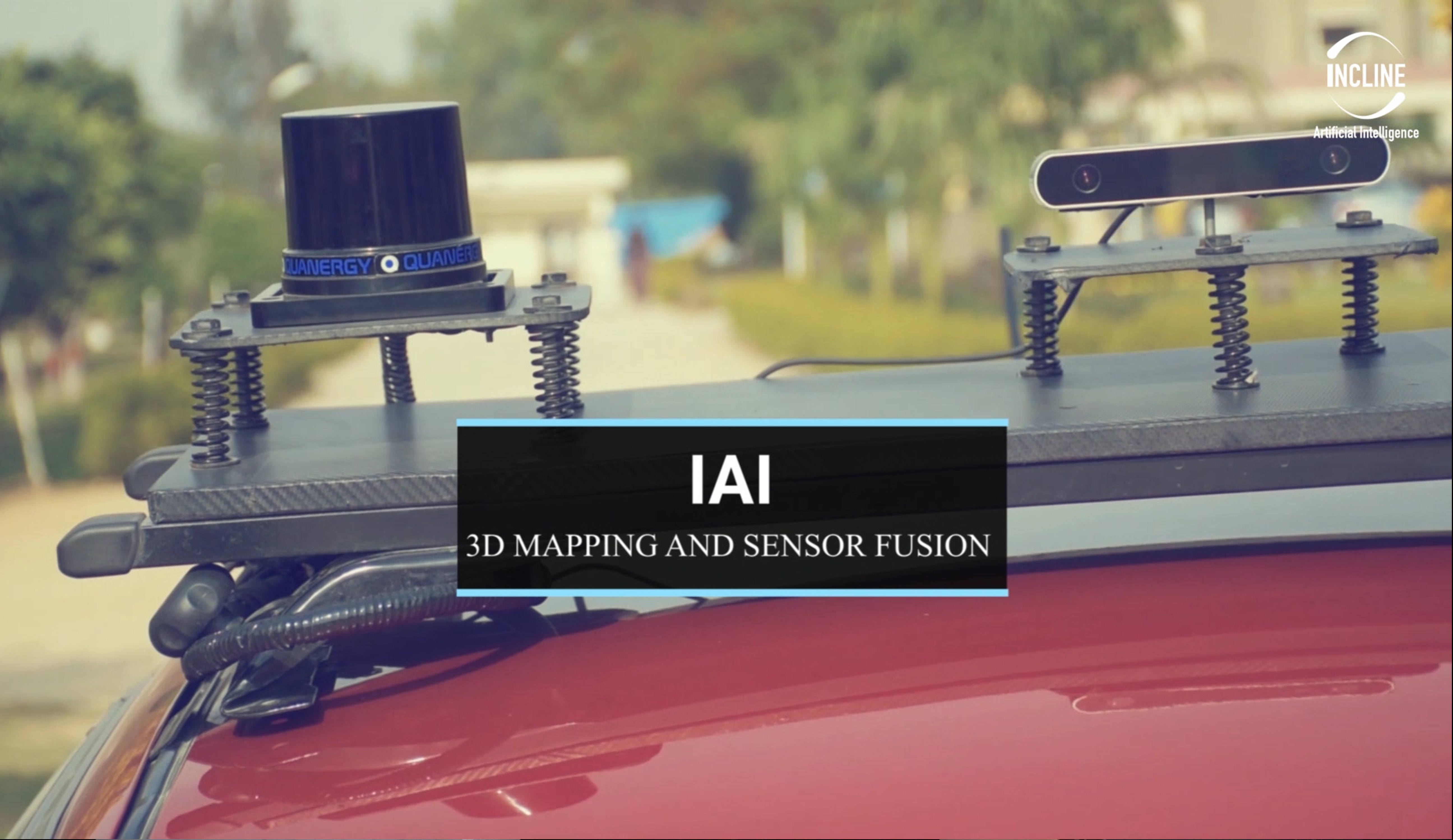
IAI 3D Scenery includes digitization of a surrounding environment after our mapping van is passed through that. It uses Hi-tech cameras, a variety of sensors and lidar as hardware. The raw sensor data is then processed, and sensor fusion techniques are applied which in turn, generates real world 2D/3D Maps.
IAI 3D Mapping
The goal of this project is to provide a real-time rendered digital model that will represent terrain surfaces, sites, buildings, vegetation, infrastructure and landscape elements in three-dimensional scale. Further beyond outdoor city models, indoor information that is, the interior structure of buildings will be represented and made available as well.
CORE FEATURES
Multilane Identification
System identifies single as well as multilane roads for advanced road maps generation. Lane marking can be expressed in the respect of its color, number of lines, and broken-or-solid style.
Road Spirals & Curves Identification
System generates detailed road network maps with connected roads, round about and road spirals as well.

Road Objects Classification
System detects all the possible road objects like Vehicles, Motorbikes, Humans and Animals etc.

Traffic Signals Identification
System has plan to identify traffic signals to include signals details as well into 3D Maps.

Traffic Sign Detection & Classification
System identifies traffic sign boards and includes the details into 3d Maps.